
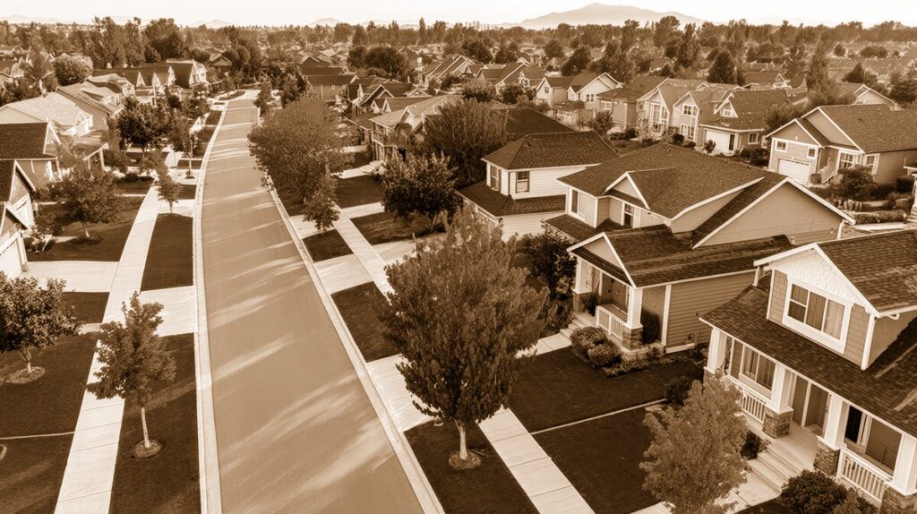
A Neighborhood Shaped by the Mountain
At the northern edge of Upland, where Mountain Avenue meets 24th Street, San Antonio Park feels like more than a place for ball games and picnics. It is the community’s front porch—a green, familiar gathering place that connects the city of Upland with the unincorporated community of San Antonio Heights.
Although “San Antonio Park neighborhood” is often used informally to describe the homes and streets around the park, the area is part of a larger historic landscape. San Antonio Heights lies north of Upland, close to San Antonio Canyon and the foothills of the Angeles National Forest. Residents have long valued the area for its trees, larger lots, quiet roads, and semi-rural character.
The name “San Antonio” comes from the natural geography of the region, especially San Antonio Canyon and Mount San Antonio, the dramatic peak often called Mount Baldy. “Heights” reflects the community’s elevated position above the citrus-growing plain. Together, the name captures the setting: a foothill neighborhood overlooking the agricultural valley below.
Before the Park, an Agricultural Colony
Long before modern streets and homes, the foothills and valley were inhabited by Indigenous people, including the Tongva. In the late nineteenth century, the area became part of a rapidly developing agricultural colony. Canadian-born entrepreneurs George and William Chaffey established irrigation systems and laid out broad avenues for the community that would become Ontario and Upland. Euclid Avenue, with its unusually generous width, remains one of the most recognizable reminders of that early planning.
The northern portion of the colony was once known as North Ontario and, for a time, as the Town of Magnolia. In 1902, local residents adopted the name Upland, and the City of Upland incorporated in 1906. Citrus groves, water companies, packing houses, and transportation routes all helped the young community grow.
San Antonio Heights developed as a residential and recreational extension of this agricultural world. Its appeal was not only the cooler foothill air but also the promise of scenic living within reach of Upland’s commercial center and Ontario’s rail connections.
The Trolley That Built a Community
The most important early force in the San Antonio Park area was the Ontario and San Antonio Heights Railroad. Organized in the 1880s, the line ran north along Euclid Avenue toward the foothills. In its earliest days, a team of mules pulled the trolley uphill; passengers returned downhill by gravity. The line was electrified in the 1890s, making travel faster and helping connect San Antonio Heights with Upland and Ontario.
Transportation and real estate development went hand in hand. William G. Kerckhoff, an influential power and transportation entrepreneur, became associated with the railroad and its expansion. In the early twentieth century, his company acquired land for residential development and included a park as part of the plan. The idea was typical of the era: a trolley line could bring prospective buyers to new homes, while a nearby park offered recreation and made the subdivision more attractive.
The park therefore was not an afterthought. It was part of the original vision for the community—a place where families could gather, visitors could spend an afternoon, and new residents could imagine a life in the foothills.
The Historic Waiting Station
The finest surviving reminder of that era stands inside San Antonio Park: the Ontario and San Antonio Heights Railroad Waiting Station. Built around 1906 or 1907, the small stone-and-mortar structure served passengers at the upper end of the trolley line. Its rough stone walls, rounded arches, and sturdy proportions give it a Romanesque Revival appearance, while the use of local stone connects it visually to the foothill landscape.
The station was associated with plans to carry visitors toward San Antonio Canyon and a proposed resort near Mount Baldy. That resort was never completed as envisioned, but the station continued to serve as a transportation landmark. Pacific Electric acquired the railroad in 1912, bringing the route into the region’s expanding interurban network. Streetcar service to San Antonio Heights ended in the 1920s, as automobiles and changing transportation patterns reshaped Southern California.
In February 1925, the park property was transferred to the City of Upland. That change helped preserve the land as a public gathering place even after the trolley tracks disappeared. The waiting station was later listed in the National Register of Historic Places in 2012. Today, it contains a small interpretive display and is accompanied by a mural honoring Kerckhoff and the region’s transportation and electrical history.
From Streetcar Destination to Neighborhood Park
Over the decades, San Antonio Park changed from a trolley-era recreation destination into a modern community park. The tracks are gone, but the location remains remarkably appropriate. Mountain Avenue still leads visitors toward the foothills, while 24th Street marks the park’s connection to the surrounding residential streets.
Modern improvements expanded the park’s everyday usefulness. Today, it includes:
- Ball fields used by local youth sports
- A playground and open recreational areas
- Picnic tables, barbecue facilities, and a shelter
- Restrooms and reservable gathering space
- The preserved railroad waiting station and historic interpretation
Planning documents from the early 2000s describe improvements including Little League fields, playground areas, picnic facilities, courts, parking, and restrooms. These additions reflect the park’s continuing role as a shared civic space for both Upland residents and neighbors in San Antonio Heights.
A Community That Still Feels Connected
What makes the San Antonio Park area special is the way old and new sit comfortably together. A child playing on a modern field may be only a few steps from a stone station built when mules pulled streetcars up Euclid Avenue. Families gather under the picnic shelter while the foothills rise beyond the neighborhood. The park’s trees soften the edges of the streets, and the surrounding homes retain the spacious, quiet character that has long defined San Antonio Heights.
The neighborhood has evolved from citrus country and trolley suburb to a settled foothill community, but its central themes have remained remarkably consistent: access to nature, transportation, public gathering places, and a strong sense of local identity.
For anyone wanting to understand San Antonio Heights, a visit to San Antonio Park is a good place to begin. Walk along Mountain Avenue, look closely at the old waiting station, and imagine the streetcars arriving with families, homebuyers, and weekend visitors. The park is not simply a recreational facility. It is a small, enduring record of how this corner of the Inland Empire grew—and why generations of residents have continued to call it home.